
Exploring the Frontiers of Watershed Science: Innovations and Applications
Here are some important points to remember about the latest in watershed science:
Key Takeaways
- Big data and advanced tech like remote sensing are revolutionizing how we study watersheds.
- Citizen science offers a way to gather more data and involve the public in watershed protection.
- Understanding the link between social factors and ecological health is vital for watershed management.
- Models and decision-support tools are helping us make smarter choices for water resources.
- Bridging the gap between scientific research and practical application is a major goal.
Advancing Watershed Science with Big Data
Watersheds are complex systems, and understanding them means looking at both the water and the people who depend on it. For a long time, research focused mostly on the physical stuff – the rivers, the soil, the rain. But we're starting to see that doesn't tell the whole story. We need to consider how human activities and well-being connect with the environment. This shift towards looking at social-ecological systems is pretty big.
Leveraging Spatially-Explicit Data for Watershed Management
Think about managing a watershed. It's not just about where the water flows; it's also about where people live, farm, and work. Spatially-explicit data, which is basically information tied to a specific location on a map, is changing how we approach this. We can now combine details about land use, population density, and water quality all in one place. This helps us see patterns we couldn't before. For example, we can map out areas where agricultural runoff might be a problem and also see which communities are most affected by poor water quality. This kind of detailed mapping is key for making smart decisions about conservation and resource allocation. It allows for more targeted interventions, rather than a one-size-fits-all approach. This is especially important as we look at integrating sustainability into business strategies, learning practical skills.
Quantitative Assessment of Social-Ecological Watershed Conditions
So, we have all this data, but how do we make sense of it? We need ways to measure and assess the combined health of the social and ecological parts of a watershed. This means moving beyond just describing problems to actually quantifying them. We can create indices that combine different types of information, like water purity levels and measures of community health or economic activity. This gives us a clearer picture of the overall condition. It's like getting a report card for the whole watershed system.
Here's a simplified look at what might go into such an assessment:
- Ecological Indicators:
- Water quality metrics (e.g., dissolved oxygen, nutrient levels)
- Habitat health scores
- Biodiversity counts
- Social Indicators:
- Population demographics
- Economic activity levels
- Access to clean water resources
This kind of quantitative approach helps us track changes over time and see if our management efforts are actually working. It’s a step towards making watershed management more data-driven and effective.
Integrating Biophysical and Human Well-being Data
Putting it all together is the real challenge. We're talking about combining data on things like rainfall patterns and soil erosion with data on people's health, livelihoods, and access to resources. It's about recognizing that these two sides are deeply connected. For instance, a healthy forest upstream might mean cleaner water for a town downstream, which in turn affects public health and local economies. Big data makes it possible to analyze these connections at scales we couldn't before. This integrated view is vital for understanding trade-offs and finding solutions that benefit both people and the environment. It helps us move towards a more holistic approach to watershed management, where we consider the full picture. This is also relevant when thinking about reporting on environmental impacts, like GHG accounting.
The availability of vast, varied, and geographically detailed datasets is opening new doors. We can now start to quantitatively link the physical state of our watersheds with the well-being of the communities that rely on them. This wasn't really feasible on a large scale until recently. It's a game-changer for understanding these intricate systems.
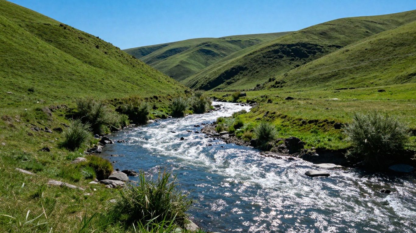
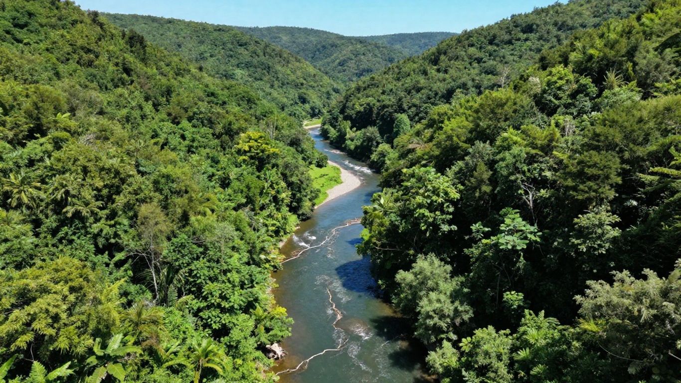
Innovations in Remote Sensing for Watershed Monitoring
Remote sensing has really changed how we look at watersheds. It's like having eyes in the sky, giving us a broad view without having to trudge through every stream and field. This technology lets us track changes over large areas and over time, which is super helpful for managing water resources.
Satellite Imagery for Surface Water and Storage Analysis
Satellites are fantastic for seeing how much water is where. They can map out lakes, rivers, and even estimate how much water is stored in them. Think about tracking drought conditions or flood risks – satellite data gives us a big picture view. For instance, studies have used satellite data to monitor changes in lake water storage, which is pretty neat when you consider how much water we rely on. It helps us understand the overall water balance in a region.
Unmanned Aerial Vehicles in Water Quality Assessment
Then there are drones, or Unmanned Aerial Vehicles (UAVs). These are smaller and can get up close and personal with water bodies. They're great for taking high-resolution pictures and collecting specific data. Researchers are using them to check water quality, like measuring suspended solids. It's a more targeted approach than satellites, allowing for detailed checks in specific areas that might be having problems. Some work even looks at using drone images to predict things like total suspended solids in water, which is pretty advanced stuff.
Evaluating Remote Sensing for Biodiversity and Land Cover
Beyond just water, remote sensing helps us understand the whole watershed environment. Satellite sensors can map out different types of land cover – forests, farms, urban areas – and how they change. This is important because land cover directly affects water runoff and quality. We can also use these tools to get a sense of biodiversity, looking at habitat health. It's all connected, you know? Understanding the land helps us manage the water better. This kind of work is key for developing better watershed management strategies, as highlighted in research on GIS and remote sensing.
The ability to collect data from above, whether from vast satellite networks or nimble drones, provides an unprecedented view of watershed dynamics. This perspective is vital for understanding complex environmental processes and for making informed decisions about water management and conservation efforts.
The Role of Citizen Science in Watershed Research
When we talk about watershed science, it's easy to get lost in the complex models and high-tech equipment. But there's a growing movement that brings everyday people right into the heart of scientific discovery: citizen science. This approach taps into the power of the public to collect data and contribute to our understanding of water systems. It's not just about having more eyes on the ground; it's about building a connection between communities and the water resources they depend on.
Scaling Up Citizen Science for Environmental Impact
Citizen science projects are getting bigger and more organized. Think about it: instead of just a few scientists collecting samples, you have hundreds or even thousands of people gathering information across a whole watershed. This massive data collection can really make a difference. It helps us see patterns we might miss otherwise and provides a broader picture of water quality and ecosystem health. These efforts can lead to more effective environmental initiatives and better management strategies. It’s about turning local observations into impactful, large-scale environmental action.
Complementarity of Citizen and Agency Monitoring Data
Now, you might wonder how citizen data stacks up against what official agencies collect. The truth is, they work best together. Agencies often have the resources for in-depth analysis and long-term monitoring, but citizen scientists can fill in the gaps. They can collect data more frequently, cover more areas, and provide real-time insights that might otherwise be missed. This combination creates a more robust dataset, giving scientists a clearer, more complete view of watershed conditions. It's like having a detailed map from the experts, plus a street-level view from people on the ground.
Here’s a quick look at how the data types can complement each other:
Smartphone Applications for Water Quality Assessment
One of the coolest developments in citizen science is the rise of smartphone apps. These tools make it super easy for anyone to collect and share water quality data. You can often use your phone to record observations, take pictures, and even conduct simple tests. This information can then be sent directly to researchers or water management agencies. It’s a simple way to get involved and contribute to scientific understanding. These apps are making water quality monitoring more accessible than ever before, helping us track things like temperature, pH, and turbidity in real-time.
The integration of technology, like mobile apps, has dramatically lowered the barrier to entry for public participation in scientific research. This democratization of data collection allows for unprecedented spatial and temporal coverage, providing a richer dataset for analysis and decision-making in watershed management.
This kind of widespread data collection is vital for understanding how our actions affect water bodies and for developing strategies to protect them. It’s a powerful way to connect people with their local environment and contribute to broader goals, like achieving net-zero carbon by providing better environmental data.
Integrating Social and Ecological Dimensions in Watersheds

Social-Ecological Network Analysis in Restoration Efforts
Watersheds aren't just about water and land; they're also about people and how we interact with these natural systems. For a long time, we tended to look at the ecological side of things separately from the human side. But that's changing. We're starting to see that managing watersheds effectively means understanding the whole picture – how human activities impact water quality and quantity, and how the health of the watershed, in turn, affects our communities. This shift is leading to new ways of thinking about restoration projects. Instead of just planting trees or cleaning up a riverbed, we're looking at the connections between different groups of people, their actions, and the environment. It’s about mapping out who is involved, what their interests are, and how their decisions ripple through the watershed. This kind of analysis helps us figure out the best places to focus our efforts for the biggest positive impact. It’s a bit like trying to understand how a sports team works; you need to know how each player interacts with others and with the game itself. This study introduces an integrated social-ecological network framework to analyze these complex relationships.
Understanding Governance and Institutional Structures
When we talk about managing watersheds, we can't ignore the rules, organizations, and policies that are already in place. These are the governance and institutional structures. Think about it: different government agencies might have overlapping responsibilities, local communities might have their own traditions for water use, and businesses might have specific regulations they need to follow. All these pieces affect how a watershed is managed. Sometimes these structures work well together, and sometimes they create confusion or conflict. Understanding these existing systems is key to making any changes or improvements. It helps us identify who has the authority to make decisions, who needs to be consulted, and where potential roadblocks might be. Without this knowledge, any plan for watershed improvement could easily get stuck in bureaucratic red tape or run into unexpected opposition.
Reconciling Spatial Boundaries of Watersheds and Social Systems
One of the trickiest parts of watershed science is that the natural boundaries of a watershed – where the water flows – don't always line up with the boundaries we use for human organization, like city limits, county lines, or even state borders. This mismatch can cause a lot of problems. For example, a city might be upstream and pollute a river that flows through several other towns downstream, but those downstream communities have little say in how the upstream city manages its wastewater. This disconnect between where water goes and how people are organized is a major hurdle in effective watershed management. We need ways to bridge this gap, to get people who live in different administrative areas but share the same water resources to work together. It requires careful consideration of scale and finding common ground, even when people are looking at the watershed from very different perspectives. It’s a bit like trying to coordinate a large event where everyone has a different map; you need a way to make sure everyone is looking at the same overall picture. It’s a complex puzzle, but figuring it out is vital for the health of our water and our communities. It’s also about recognizing that our actions in one place can have consequences far away, a concept that is becoming increasingly clear as we look at the interconnectedness of modern life.
Modeling and Decision Support for Watershed Management
When we talk about managing watersheds, it's not just about looking at maps and data; it's about building tools that help us make smart choices. This is where modeling and decision support systems come into play. Think of them as the brains behind the operation, taking all the complex information about a watershed and turning it into actionable insights.
GIS-Based Water Balance and Resource Management Models
Geographic Information Systems (GIS) are super handy for this. They let us visualize and analyze spatial data, which is pretty much everything when it comes to watersheds. By using GIS, we can create models that track how water moves through a watershed – where it comes from, where it goes, and how much is available. These models help us understand things like how much water is stored underground or how much is lost to evaporation. This kind of detailed water balance information is key for planning how to use and protect water resources. For example, a model might show that a certain area is drawing down its groundwater faster than it's being replenished, signaling a need for conservation. We can also use these models to figure out the best places to put new infrastructure or conservation areas. It’s all about getting a clear picture of the water cycle in a specific place.
Decision Support Frameworks for Conservation Practices
Once we have a good understanding of the watershed, we need ways to decide what actions to take. Decision support frameworks are designed to do just that. They often combine data from various sources – like soil types, land use, and rainfall patterns – with scientific knowledge to recommend specific conservation practices. For instance, if a model shows high erosion risk in a particular spot, a decision support system might suggest planting specific types of vegetation or implementing certain farming techniques. These systems can help land managers and policymakers weigh different options and choose the most effective strategies for things like reducing pollution or improving habitat. It's about making informed choices that have a real impact on the ground. Some frameworks even try to incorporate stakeholder input, which is a big deal for getting buy-in and making sure solutions work for everyone involved. You can find more on developing decision support systems that integrate AI and real-time monitoring.
Real-time Decision Support for Salinity Management
In some areas, managing salinity – the saltiness of the water – is a major challenge. This is especially true in coastal regions or areas with intensive agriculture. High salinity can harm crops, affect drinking water supplies, and damage ecosystems. Real-time decision support systems for salinity management are pretty advanced. They use continuous monitoring data, often from sensors in the field, to track salinity levels as they change. When levels start to rise above a certain threshold, the system can alert managers and suggest immediate actions. This might involve adjusting irrigation schedules, changing water release from reservoirs, or even implementing temporary barriers. The goal is to react quickly to prevent or minimize the negative impacts of high salinity. It’s a dynamic process that requires constant data and quick responses. These systems are becoming more common as technology improves, allowing for more proactive management of water quality issues. It's like having a constant check-up on the water's health, with immediate advice on how to keep it in good shape.
Addressing Challenges in Watershed Science Applications
Okay, so we've talked a lot about cool new ways to study watersheds, but let's be real, it's not all smooth sailing. There are some pretty big hurdles we need to jump over before we can really make this science work on a large scale.
Reconciling Diverse Spatial and Administrative Boundaries
One of the trickiest parts is that nature doesn't really care about our lines on a map. Watersheds, by their very definition, follow the lay of the land – where water flows. But then we have all these other boundaries: county lines, state borders, political districts, even different agencies managing bits and pieces. Trying to get these different systems to talk to each other and work together is a headache. It's like trying to fit square pegs into round holes sometimes. We need better ways to make these boundaries align, or at least understand how they overlap and conflict. This is a big deal for effective watershed management.
The Need for Finer-Scaled Quantitative Research
While we're getting better at collecting tons of data, we often still lack the really detailed, ground-level information needed to understand why things are happening. We can see patterns from space, but what's actually going on at the local level? We need more focused studies that dig into the specifics. This means getting out there and doing more detailed measurements and observations, not just relying on broad-stroke data. It's about understanding the nitty-gritty mechanisms that drive watershed health and human interactions within them.
Bridging the Gap Between Theory and Large-Scale Application
We've got some really interesting ideas and theories about how social and ecological systems interact in watersheds. The problem is, turning those theories into practical, real-world applications that work across entire regions is tough. A lot of the current research is still pretty theoretical or only looks at small areas. We need to figure out how to scale up these findings and make them useful for actual decision-making. This is where conferences like the 2026 Watershed Management Conference come in, trying to bridge that gap. It's about moving from "what if" to "how do we do this" on a grand scale. We also need to think about how these management strategies align with broader goals, like managing greenhouse gas emissions, which is something organizations like the GHG Management Institute are focused on.
Dealing with tough problems in watershed science can be tricky. But don't worry, we've got solutions! If you're looking for ways to improve how we understand and manage our water systems, you've come to the right place. Visit our website to discover how we can help you tackle these challenges head-on.
Conclusion
The field of watershed science is rapidly evolving, moving beyond just looking at water and land to understanding the complex connections between nature and people. By using new tools like big data, satellite imagery, and even smartphone apps, scientists can get a clearer picture of how our watersheds are doing. Citizen science also plays a big role, bringing more eyes and hands to the table. However, there are still challenges, like dealing with different map boundaries and making sure our research helps real-world decisions. The future of watershed science lies in bringing all these pieces together to manage our water resources more effectively for everyone.
Frequently Asked Questions
What is watershed science all about?
Watershed science is basically the study of how water moves through a specific area of land, called a watershed. It looks at everything that affects the water, like the land, plants, animals, and even the people living there. It's all about understanding how these parts work together and how we can keep our water clean and healthy.
How is 'big data' used in watershed science?
Think of 'big data' as a huge amount of information collected from many different places, like weather stations, satellites, and sensors. Scientists use this massive amount of data to see patterns and understand water systems on a much larger scale than before. It helps them spot problems and make better plans.
What's the deal with remote sensing in water studies?
Remote sensing means using tools like satellites or drones to gather information about the Earth from a distance. For watersheds, this can mean looking at how much water is in lakes, checking water quality, or mapping out land cover changes without actually having to go out to every single spot. It's like having super-powered eyes in the sky.
Why is citizen science important for watersheds?
Citizen science is when regular people help scientists with their research. For watersheds, this could mean people taking water samples with simple kits or using apps to report what they see. It helps collect way more information than scientists could alone and gets more people involved in caring for their local water.
What does 'social-ecological' mean for watersheds?
This just means that scientists are looking at how people and nature are connected in a watershed. It's not just about the rivers and trees, but also about how people's actions affect the environment and how a healthy environment benefits people. They're studying the whole system, both the natural parts and the human parts, as one.
Are there challenges in managing watersheds?
Oh yeah, there are definitely challenges! One big one is that political boundaries (like county lines) don't always match up with natural watershed boundaries. It can be tricky to get everyone on the same page. Also, sometimes the research scientists do doesn't easily translate into real-world actions, so figuring out how to make the science useful is a big job.

