
How to find out what watershed you live in
Key Takeaways
Understanding your home's relationship to surrounding water systems is essential for environmental stewardship and local awareness. Here are the core concepts to guide your discovery:
- Watersheds are land areas where all precipitation drains to a common point.
- Natural topography dictates how water moves across the surface toward streams.
- Online mapping platforms allow residents to find their specific drainage basins.
- Human activity significantly alters how water collects and transports pollutants downstream.
- Protecting water quality starts with individual actions taken at the household level.
Understanding local watersheds
Learning about the hydrology of your area reveals a profound connection between the land beneath your feet and the rivers that sustain nearby ecology. When people ask what watershed do we live in, they are essentially looking for an address defined by gravity and geography rather than municipal boundaries. This inquiry helps clarify how rainfall interacts with our surroundings, transforming from a simple weather event into a critical part of the regional survival cycle.
Definition of a watershed
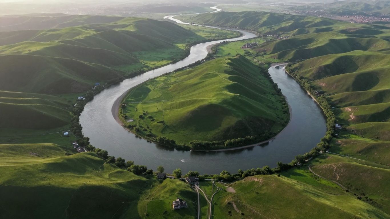
A watershed is a specific land area that captures all precipitation, such as rain or snow, and directs it toward a common exit point like a river, lake, or bay. Think of it as a giant bowl spanning the landscape; any drop that falls within the rim will eventually slide down the slopes to gather in the center or at the lowest point. This fundamental concept implies that even if you live miles from a large river, the street or backyard you occupy is part of a complex, miniature drainage network that contributes to the larger system.
Why your watershed matters for the local environment
Because every piece of land is part of an interconnected web, what happens upstream inevitably determines the health of the water body downstream. Every home, business, and park serves as a potential source for water quality changes, making the protection of these ecological drainage basins a community priority. Since water flows downhill, any substance left on the ground—from excess fertilizer to motor oil—can be mobilized by storm events and carried directly into the local creek, affecting everything from local fishing spots to shared drinking water sources.
The interconnected nature of regional water systems
Water systems do not exist in isolation, operating instead as a hierarchy of nested units. Small catchments drain into streams, which join larger rivers, which eventually lead to primary basins and the ocean. Understanding this flow means recognizing that our local environmental impact contributes to the health of distant regions, proving that regional water systems are physically linked across every mile of the state.
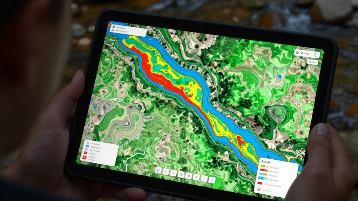
Using online tools to identify your region
Modern digital resources have made it easier than ever for residents to define their own landscape boundaries with high precision. By entering an address, you can view layers that show elevation and flow path data that were previously locked away in technical government files.
Environmental Protection Agency locator tools
The most accessible way to start your search is by using national databases that aggregate hydrology data across the entire continent. You can use tools such as the Model My Watershed platform to visualize how your specific land unit fits into the national drainage picture. These portals are designed to be user-friendly, helping citizens connect their personal property details with broader scientific data points without requiring advanced geographic information systems experience.
State-level environmental department resources
Most states maintain their own specialized mapping portals specifically designed for residents of that particular region. Locals in Virginia can visit the interactive shed map provided by their state resources to see clearly defined boundaries. These state-hosted tools often include specific overlays for local monitoring sites, permit boundaries, and conservation efforts that national maps might lack. Using these resources allows you to coordinate with Breathe ESG methods for environmental monitoring in your business if you operate within these specific catchments.
Interactive geographic mapping platforms
Beyond specialized hydrology tools, general geographic mapping software is often integrated with hydrological layers that show blue-line streams. These platforms are useful because they allow you to switch views between satellite imagery and terrain maps, providing a quick visual reference for how your street slopes toward the nearest waterway. They are especially helpful for residents looking to identify natural landmarks like ridges or valleys that define their immediate catchment area.
Interpreting topographic and drainage maps
Once you have identified your general region, learning to read technical maps can provide a clearer picture of your specific environmental footprint. Professional hydro-data analysis is often facilitated by software that helps organizations track Breathe ESG metrics over time. Visualizing your area requires looking for structural indicators that reveal where water naturally gathers and flows.
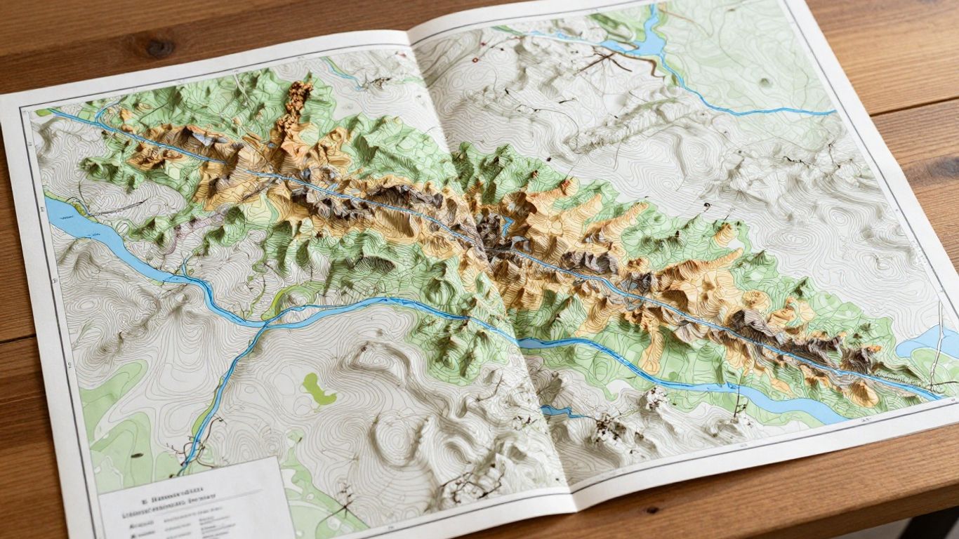
Reading contour lines for elevation data
Topographic maps use thin lines, known as contours, to represent the change in vertical elevation across the land. If lines are packed closely together, the terrain is steep, meaning water will move across that surface with high velocity during heavy storms. When contour lines are spaced far apart, the terrain is relatively flat, potentially allowing for more infiltration into the soil.
Identifying natural drainage patterns
The following features are commonly found on drainage maps to help you track water movement throughout your local area:
These maps serve as a reliable guide for understanding why some areas in your neighborhood might experience periodic flooding while others remain perfectly dry. If you are ever curious about Breathe ESG environmental reporting, these maps provide the necessary baseline to understand where runoff originates.
Understanding how surface runoff dictates boundaries
Surface runoff follows gravity, and when you trace this path on a map, you effectively draw the border of your watershed. Boundaries are defined by the highest points in a landscape—usually ridges or mountain crests—that force water to move in one direction or the other. Once a rain drop crosses that threshold, its destination is predetermined, defining exactly which river system it will support.
Exploring local water quality reports
Keeping an eye on health trends in your basin is an important step toward better stewardship and informed living. These reports provide a snapshot of what is floating in your streams and whether that water meets health safety goals.
Accessing regional watershed assessment data
Regional agencies frequently compile detailed assessments that detail the health of local catchments. These reports are often posted online for public access, categorized by the name of the river or stream they monitor. They serve as a public record of how successfully the community is managing pollution and maintaining aquatic health.
Identifying primary pollutants in your catchment
Pollutant sources are typically grouped into two categories: point sources and non-point sources. The reports will list problematic contaminants, ranging from high bacteria levels to an excess of nutrients like nitrogen and phosphorus. These pollutants have distinct origins, and understanding them helps in identifying where the primary risks exist.
Finding community-led conservation opportunities
Watershed management is a collaborative effort that is best addressed by groups with direct interests in the land. Many local organizations hold regular volunteer cleanup events or tree-planting days aimed at slowing down runoff.
- Join a local stream walk team to inspect banks for erosion.
- Participate in water quality testing workshops conducted by local environmental groups.
- Help coordinate neighborhood groups dedicated to responsible native plant gardening.
- Support local restoration projects by sharing information with your community stakeholders.
These activities not only improve water quality but also foster a deeper sense of connection to your home's natural environment.
Impacts of human activity on your watershed
Development and daily life have changed the natural flow of water in ways that require active management to stay safe. Asphalt and concrete prevent water from soaking into the ground, drastically increasing the speed and volume of runoff.
Land use and urban development effects
Cities with heavy development often face challenges related to increased flood risk and poor stream health due to the conversion of soil fields into hard surfaces. This shift changes the landscape from one that absorbs water to one that rejects it, forcing massive amounts of runoff into small streams that were not designed to handle that volume.
Stormwater management in residential areas
Residential stormwater management focuses on capturing water before it enters the main stream and causes damage. Techniques like rain barrels, bioswales, and permeable paving help mimic the natural soil absorption process in suburban settings. These systems ensure that we manage the velocity of outflow during heavy storms.
How individual household actions affect downstream health
Individual choices in the yard and the street significantly influence the final water conditions observed miles away. From properly disposing of waste to minimizing chemical use during gardening, every household plays a distinct role in keeping the stream cleaner. Small changes multiplied by every resident in a basin reach contribute to significant improvements in downstream water quality.
Conclusion
Knowing your watershed connects you to the larger natural reality that sustains our communities and regional water supplies. By utilizing local mapping resources, identifying your land's specific drainage patterns, and adopting mindful habits, you can play a part in protecting the health of the waterways that define your home.
Frequently Asked Questions
What is a drainage basin?
A drainage basin is another term for a watershed, describing the area of land where all water collects and drains to a single point such as a river or lake.
How do I find my specific watershed address?
You can find your specific watershed by using online state-hosted interactive mapping tools that allow you to search by your street address.
Does every piece of land belong to a watershed?
Yes, every location on Earth, regardless of its topography, contributes its surface runoff to a specific body of water, meaning everyone lives in some form of a watershed.
Can my watershed change over time?
While the fundamental topography typically remains the same, human development, major land shifts, or significant infrastructure projects can physically alter how water flows across the surface, potentially changing the drainage configuration.
Why does drinking water quality depend on my watershed?
Because many public drinking supplies rely on surface waters like rivers and reservoirs, the pollution captured by the watershed directly impacts the quality of the water that reaches treatment plants.
How large is a typical watershed?
Watersheds vary in size from small areas draining a single hill into a creek, to massive river basins that cover entire states and drain continents into the ocean.
How can I report pollution in my local stream?
Most local environmental departments have a dedicated website or hotline for reporting illegal dumping or observed pollution in local waterways to ensure quick corrective action.

