
Understanding Your Local Environment with a Watershed Model
Ever wonder where the water goes after it rains in your neighborhood? It all drains into a watershed, a sort of natural basin that collects water. Understanding these areas is super important for keeping our local water clean. That's where a watershed model comes in handy. Think of it like a mini-map that shows how water moves across the land and what happens to it along the way. We can use these models to see how things like roads, houses, and even our backyards affect the water quality in our local streams and rivers. It’s a really practical way to get a handle on our local environment.
Key Takeaways
- A watershed is simply the area of land where all the water that falls on it drains into a common place, like a river or lake. Everyone lives in a watershed.
- Using a watershed model, whether it's a simple hands-on activity or a digital tool, helps visualize how water flows and how different land uses impact water quality.
- These models are great educational tools, making complex environmental concepts easier for students and communities to grasp, especially when tied to local areas.
- By simulating different scenarios, a watershed model can help identify pollution sources and test the effectiveness of solutions like rain gardens or better land management.
- Advanced watershed model tools can incorporate data on climate change and land development to predict future impacts and help plan for a healthier environment.
Exploring the Concept of Watersheds with Models
Defining a Watershed and Its Importance
So, what exactly is a watershed? Think of it as a giant, natural drainage basin. It's any area of land where all the water that falls on it – rain, snowmelt – eventually flows downhill to a common point, like a river, lake, or even the ocean. This means that no matter where you are, you're living in a watershed. Understanding this concept is pretty important because everything that happens on the land within that area can affect the water quality downstream. Pollution from a farm field miles away, for instance, can end up in your local river. It’s all connected.
Here’s a simple way to think about it:
- High Points: Ridges and hills act as boundaries. Water flows away from these.
- Low Points: Valleys and channels guide water towards streams and rivers.
- Outlet: The lowest point where water leaves the watershed.
Knowing your local watershed helps you see how your actions, and those of your neighbors, impact the water we all share. It’s the first step in figuring out how to keep our water clean.
The idea of a watershed is simple but powerful. It shows us that water doesn't just appear; it travels, collecting things along the way. What we do on the land directly influences the water's journey.
Hands-On Activities for Understanding Watersheds
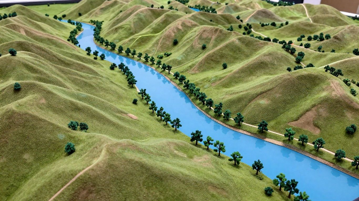
Talking about watersheds is one thing, but actually seeing one in action is way better. One cool way to get a feel for it is by building a simple model. You don't need fancy equipment. Grab a large plastic sheet, maybe an old shower curtain, and drape it over some chairs or a table to create a landscape. Then, use a spray bottle to simulate rain. Watch where the water collects and flows. You can even add little "mountains" or "valleys" with crumpled paper or pillows underneath the sheet to see how topography changes water flow. This hands-on approach really makes the concept click. It helps visualize how watershed delineation works, showing how water finds its path.
Another activity involves exploring your own backyard or local park. Look for signs of water flow after it rains. Where does the water pool? Where does it seem to run off? You might be surprised what you notice. You can even use simple tools to test water quality in different spots, though that gets into more advanced topics.
Connecting Watershed Models to Local Environments
Models aren't just abstract ideas; they're tools to understand our own backyards. When we create a model, whether it's a physical one with a shower curtain or a digital one, we're trying to represent our real world. The goal is to see how water moves across the land in our specific area. This helps us understand where our drinking water comes from, where stormwater goes after a big rain, and what might be affecting the health of our local streams and rivers. It’s about taking a big concept like watershed hydrology and making it personal. By focusing on our local watershed, we can start to see how things like roads, buildings, and even our lawns affect the water quality. This local connection is what makes learning about watersheds so meaningful and can lead to real action.
Components and Structure of a Watershed Model

Physical and Biological Elements Included in Models
When we build a watershed model, we're trying to represent a real place, so we need to include the important bits. Think about what makes up a watershed: the land, the water, and the living things. Models often start by mapping out the terrain – the hills, valleys, and flat areas. This is super important because it dictates where water will flow. Then, we add the water bodies themselves: rivers, lakes, and maybe even wetlands. These aren't just static features; they change. Water levels go up and down, and the water itself moves. We also need to think about the living parts, like forests, fields, and even urban areas. These different land covers affect how water soaks into the ground or runs off the surface. The goal is to capture the interactions between these physical and biological components.
Simulating Water Flow and Runoff
This is where the "model" part really comes alive. We want to see how water moves across the landscape. When it rains or snow melts, where does that water go? A good model will simulate this runoff. It considers things like how steep the land is, what kind of ground cover is there (grass, pavement, bare soil), and how saturated the ground already is. Some models can even show how water seeps into the ground, becoming groundwater. This helps us understand how quickly water reaches streams and rivers, and how much water might be flowing during different weather events. Tools like the HSPF model are designed specifically for this kind of simulation, looking at how water moves and what it carries along.
Representing Human Activities and Land Use
People are a big part of any watershed, and our activities definitely change how water behaves. Models need to account for this. This means including different types of land use: farms, cities, forests, and suburbs. Each of these has a different impact. For example, paved surfaces in a city mean less water soaks into the ground, leading to more runoff. Agricultural areas might have different types of soil disturbance or fertilizer use that can affect water quality. Models can also represent things like roads, buildings, and even how much water is being used by people. Some advanced models even try to predict how future development might change these patterns. Understanding these human influences is key to managing our water resources effectively. For instance, the Chesapeake Bay Program uses tools that look at land use changes to predict pollution loads.
Models are simplified versions of reality. They don't capture every single detail, but they focus on the most important factors that influence water flow and quality within a watershed. The trick is to make them detailed enough to be useful but simple enough to understand and work with.
Utilizing Watershed Models in Community Education
Incorporating Models into School Curriculum
Getting kids interested in their local environment can be a challenge, but watershed models offer a really neat way to do it. Think about it: instead of just reading about water cycles, students can actually build and interact with a model that shows how water moves across land. This hands-on approach makes abstract concepts much more concrete. Many programs are designed to fit right into existing school lessons, covering topics from basic water movement to how pollution travels. These educational tools help students see their own community's water system in a new light. For example, the Shared Waters curriculum provides a 10-lesson plan for grades 3-6 that uses resources like the WikiWatershed Toolkit to teach about local watershed issues. It's all about making learning relevant to where they live.
Engaging Students with Real-World Data
It's one thing to talk about water quality, but it's another to actually test it. Watershed models can be linked to real data, showing students the actual conditions of their local streams or rivers. This can involve simple field trips where students collect water samples or use sensors. They can then use tools like the Model My Watershed app to see how different conservation ideas might improve water health. This process often involves a few key steps: first, students become aware of an issue, then they explore it through investigation, and finally, they use tools to suggest solutions. Grounding this learning in their local environment makes it stick.
Here’s a look at how students might engage:
- Observation: Visiting a local stream or pond.
- Testing: Measuring water temperature, pH, or clarity.
- Modeling: Using software to predict the impact of changes.
- Action: Planning a project to help their watershed.
Fostering Watershed Stewardship Through Modeling
When students actively participate in understanding and modeling their watershed, it sparks a sense of responsibility. They start to see how their actions, and the actions of their community, directly affect the water quality. This connection can lead to a desire to protect and improve their local environment. It’s about moving from just learning about a problem to actively seeking solutions. This kind of engagement can lead to real change, as students become advocates for cleaner water in their own backyards. The Watershed Project, for instance, focuses on this kind of hands-on environmental education to build that connection.
Building a model of a local watershed helps students connect abstract scientific concepts to their immediate surroundings. This place-based learning approach makes the information more meaningful and encourages a sense of ownership over environmental issues. When students can see the direct impact of human activities on their local water sources, they are more likely to become active participants in conservation efforts.
Evaluating Water Quality with a Watershed Model
Testing for Pollutants and Identifying Sources
So, you've got your watershed model set up. Now what? It's time to get down to business and figure out what's actually going on with the water. This is where the model really shines, helping us see beyond just the pretty streams and understand the hidden stuff. We can use it to simulate how different things might affect water quality. Think about it: where does that fertilizer from Farmer McGregor's field end up? Does that leaky old gas station down the road contribute anything nasty? The model can help us trace these pathways. It's like being a detective for your local river. We can input data about potential pollution sources – like agricultural runoff, industrial discharge, or even just storm drains in a busy town – and see how those loads travel through the watershed. This helps pinpoint where the problems are originating, which is the first step to fixing them. We can even compare different scenarios to see which sources are the biggest culprits.
Analyzing Stormwater and Runoff Patterns
Stormwater is a big deal, especially in developed areas. When it rains, water rushes over roads, parking lots, and rooftops, picking up all sorts of gunk along the way. This polluted runoff then flows into our streams and rivers, often without any treatment. A watershed model can show us exactly how this happens. It can map out where the water goes, how fast it moves, and what it picks up. We can look at:
- Impervious surfaces: Areas like roads and buildings that don't let water soak in.
- Drainage networks: How storm drains and ditches channel water.
- Flow accumulation: Where water tends to gather and move quickly.
Understanding these patterns is key to managing stormwater. For instance, the model might show that a particular neighborhood has a lot of runoff because of its large paved areas. This insight could lead to ideas for managing that water better, like installing rain gardens or permeable pavements. It's all about seeing the bigger picture of how rain interacts with the landscape. You can even use tools like the Chesapeake Assessment Scenario Tool (CAST) to explore how different land management choices might affect water flow and quality.
Understanding the Role of Aquatic Macroinvertebrates
Okay, so we've looked at the physical stuff – the flow, the pollutants. But what about the living things? Aquatic macroinvertebrates, which are basically bugs, worms, and other small critters that live in the water, are fantastic indicators of water health. Some are really tough and can survive in pretty yucky water, while others are super sensitive and will only live in clean, healthy streams. By sampling these critters in different parts of our watershed, and then comparing that data to what our model predicts about water quality in those same areas, we can get a really good picture. If a spot in the model shows potential pollution issues, but we're finding only hardy macroinvertebrates there, it confirms our suspicions. Conversely, if the model suggests good water quality and we find a diverse range of sensitive critters, that's a great sign! It's like having a natural report card for the stream. These biological indicators provide a real-world check on the model's predictions, making our assessment more robust. Modeling these processes can help us understand how pollution affects the entire aquatic ecosystem.
Strategies for Improving Local Watersheds Using Models
So, you've been using a watershed model, maybe even built one yourself, and now you're wondering, 'What can I actually do about it?' That's the best part! These models aren't just for looking at; they're tools to help us figure out practical ways to make our local waterways healthier. It's about taking what we learn from the model and applying it right in our own backyards and neighborhoods.
Implementing Rain Gardens and Barrels at Home
One of the most direct ways to help is by managing rainwater where it falls. Think about your roof, your driveway, or even just the lawn. When it rains, all that water runs off, picking up whatever it can – dirt, oil, fertilizers, you name it – and carries it straight into storm drains, and eventually, our rivers and lakes. Rain gardens and rain barrels are simple, effective solutions.
- Rain Gardens: These are just shallow depressions planted with native flowers, shrubs, and grasses. They're designed to soak up rainwater runoff from roofs, driveways, or other hard surfaces. The plants and soil help filter out pollutants before the water seeps into the ground or slowly flows into a storm drain. You can even get creative with the design to make them look nice!
- Rain Barrels: These collect rainwater from your downspouts. Instead of letting that water just run off, you can store it and use it later for watering your garden or lawn. This not only reduces runoff but also conserves treated tap water. It's a win-win.
Exploring Best Management Practices for Pollution Reduction
Beyond rain gardens and barrels, there's a whole range of 'best management practices' (BMPs) that models can help us identify and prioritize. These are techniques and actions designed to minimize pollution entering our waterways. For example, if your model shows a lot of sediment coming from a particular agricultural area, you might look into practices like cover cropping or no-till farming. For urban areas, things like street sweeping, proper waste disposal, and reducing fertilizer use are key. The Chesapeake Bay Program, for instance, uses tools like the Chesapeake Assessment Scenario Tool (CAST) to figure out which BMPs will give the biggest bang for the buck in reducing pollution loads [5307].
Here's a quick look at some common BMPs:
- Vegetated Buffers: Planting trees, shrubs, and grasses along stream banks helps filter runoff and stabilize the soil.
- Permeable Pavements: Using materials for driveways and sidewalks that allow water to soak through instead of running off.
- Green Roofs: Planting vegetation on rooftops to absorb rainwater and reduce runoff.
- Proper Waste Management: Ensuring trash and pet waste are disposed of correctly to prevent them from washing into waterways.
Designing Community Action Plans with Model Insights
Watershed models are powerful when we use them to plan community-wide efforts. They can help us see how different actions, when taken together across a neighborhood or town, can have a significant positive impact. For example, a model might show that if 20% of households in a certain area install rain barrels, it could reduce peak storm flow by a measurable amount. This kind of data can be really persuasive when talking to neighbors, local officials, or community groups.
Using a model helps us move beyond just talking about problems to actually proposing concrete solutions. It allows us to visualize the potential benefits of collective action, making it easier to get people on board and work together towards a cleaner watershed. It’s about making informed decisions based on how our local environment works.
These models can also be part of larger cooperative frameworks aimed at improving water quality and resilience [1682]. By understanding the flow and potential pollution points, communities can develop targeted plans that address their specific challenges, leading to healthier water for everyone. It’s amazing what can happen when we combine local knowledge with the insights from these digital tools.
Advanced Tools and Innovations in Watershed Modeling
Overview of Digital and Web-Based Modeling Tools
So, we've talked about building models, but how do we actually use them in today's world? Things have gotten pretty sophisticated. Forget building a physical model out of clay and pipes in your garage (though that's still a neat idea for some things!). Now, we've got digital tools that can do some pretty amazing stuff. Think of software that can simulate how water moves across a landscape, taking into account everything from the type of soil to how much rain is falling. These aren't just fancy computer games; they're serious tools used by scientists and planners. For instance, tools like WEAP can forecast water availability and demand, helping us figure out future water needs. It's all about using technology to get a clearer picture of what's happening in our watersheds.
Integrating Climate and Land Use Data
What's really changing the game is how we can now combine different kinds of information. It's not just about water anymore. We're bringing in data about climate change – like how rainfall patterns might shift or temperatures might rise. We're also looking closely at land use. Are we seeing more development? More farms? Less forest? Tools that use Geographic Information Systems (GIS) are fantastic for this. They let us map out land cover and see how changes might affect water runoff and quality. This ability to layer different data sets gives us a much more realistic view of how our watershed might behave in the future.
Collaborative Approaches to Model Improvement
Nobody builds these advanced models alone. It's a huge team effort. Scientists, engineers, local communities, and government folks all chip in. They share data, test the models, and suggest improvements. This collaborative process means the models get better over time – more accurate, more detailed. Think of it like a community project where everyone brings their skills to make something better for everyone. This ongoing work means we get more reliable predictions and better ways to manage our water resources. It’s a constant cycle of learning and refining.
Here's a look at how some of these tools are structured:
The development of these sophisticated modeling systems is a testament to how far we've come in understanding complex environmental systems. By integrating diverse data streams and fostering collaboration, we can create more accurate and responsive tools for managing our local water resources effectively.
Applying Watershed Model Insights to Real-World Challenges

So, you've built your watershed model, played around with it, and maybe even taught some kids about it. Now what? The real power of these models comes when we start using them to figure out what's happening in our own backyards and how we can actually make things better. It's not just about theory; it's about practical solutions.
Predicting the Impacts of Local Development
When new buildings or roads are planned, it changes how water moves across the land. A watershed model can help us see where that extra runoff might go and what problems it could cause, like flooding or carrying more pollution into our rivers. By simulating different development scenarios, we can get a heads-up on potential issues before they become major headaches. This kind of foresight is super helpful for town planners and residents alike.
Evaluating Conservation Projects and Their Effectiveness
Got a project in mind to help your local stream? Maybe planting trees along the banks or creating a wetland area? A watershed model can be used to test these ideas virtually. You can plug in the proposed changes and see how the model predicts they'll affect water flow, quality, and the overall health of the watershed. This helps make sure we're putting our efforts and money into things that will actually work.
Here's a quick look at how different conservation actions might play out:
- Rain Gardens: Can significantly reduce the amount of stormwater runoff by letting water soak into the ground.
- Permeable Pavement: Allows water to pass through instead of running off, reducing strain on storm drains.
- Riparian Buffers: Vegetated areas along waterways help filter pollutants and stabilize stream banks.
Adapting to Environmental Changes Within the Watershed
Things like changing weather patterns, with more intense storms or longer dry spells, can really mess with our watersheds. Models can help us understand how these changes might affect water availability, flood risks, and water quality over time. This information is key for making smart plans for the future, whether it's about managing water resources or protecting local ecosystems. For instance, using ensemble General Circulation Models (GCMs) has shown improvements in calibration for environmental management, proving their practical benefits [df8a].
Thinking about how our local environment is changing is important. Models give us a way to explore these changes and figure out the best ways to respond, rather than just reacting when problems pop up. It's about being proactive and making sure our communities and natural spaces can handle whatever comes next.
Understanding how watershed models work can help us solve real-world problems. These models show us how water moves and what affects it. This knowledge is super useful for keeping our water clean and safe. Want to learn more about how we can use this information to make a difference? Visit our website today!
Wrapping It Up
So, building a watershed model might seem like just a school project, but it's really about seeing your own backyard in a new light. You learn where the water goes after it rains, how it affects everything around us, and what we can do to keep it clean. It’s pretty cool to realize that even small actions, like planting a rain garden or using a rain barrel, can make a real difference right where you live. Understanding your local watershed is the first step to taking care of it, and that’s something we can all be a part of.
Frequently Asked Questions
What exactly is a watershed?
Think of a watershed as a giant bowl that catches all the rain and snow that falls in a certain area. All that water then flows downhill to a common spot, like a river, lake, or even the ocean. So, no matter where you are, you're part of a watershed!
How can I build a simple watershed model?
You can make a basic model using a plastic shower curtain! Spread it out, and imagine the bumps and dips are like hills and valleys. When you spray water on it, you can see how the water flows downhill, just like in a real watershed. You can even add little toy houses or trees to see how they affect the water's path.
Why are watershed models important for learning?
Models help us see how everything in our local environment is connected. They show us where our water comes from, where it goes, and how things like roads, farms, and even our own backyards can affect the water's journey and its cleanliness. It's like a science experiment for our own neighborhood!
What kinds of things can a model show us about water pollution?
A model can help us understand how pollution gets into our water. For example, if you add a pretend 'factory' or 'farm' to your model, you can see how dirty water from those places might flow into the river. It also helps us see how rain washing over streets can pick up trash and carry it away.
Can watershed models help us fix local water problems?
Absolutely! By using models, we can explore different ideas to help our local water. For instance, we can see how building a rain garden or putting in rain barrels might catch and clean rainwater before it flows into streams. Models help us plan the best ways to protect our water.
Are there computer tools that act like watershed models?
Yes, there are! Many websites and computer programs let you create digital models of watersheds. You can input information about your local area, like the types of land and where people live, and the computer can help predict how water will flow and what might happen if things change, like building new houses.

